 Disinfecting passengers at Mtskheta railway station during the Spanish flu pandemic. Source: National Archives of Georgia
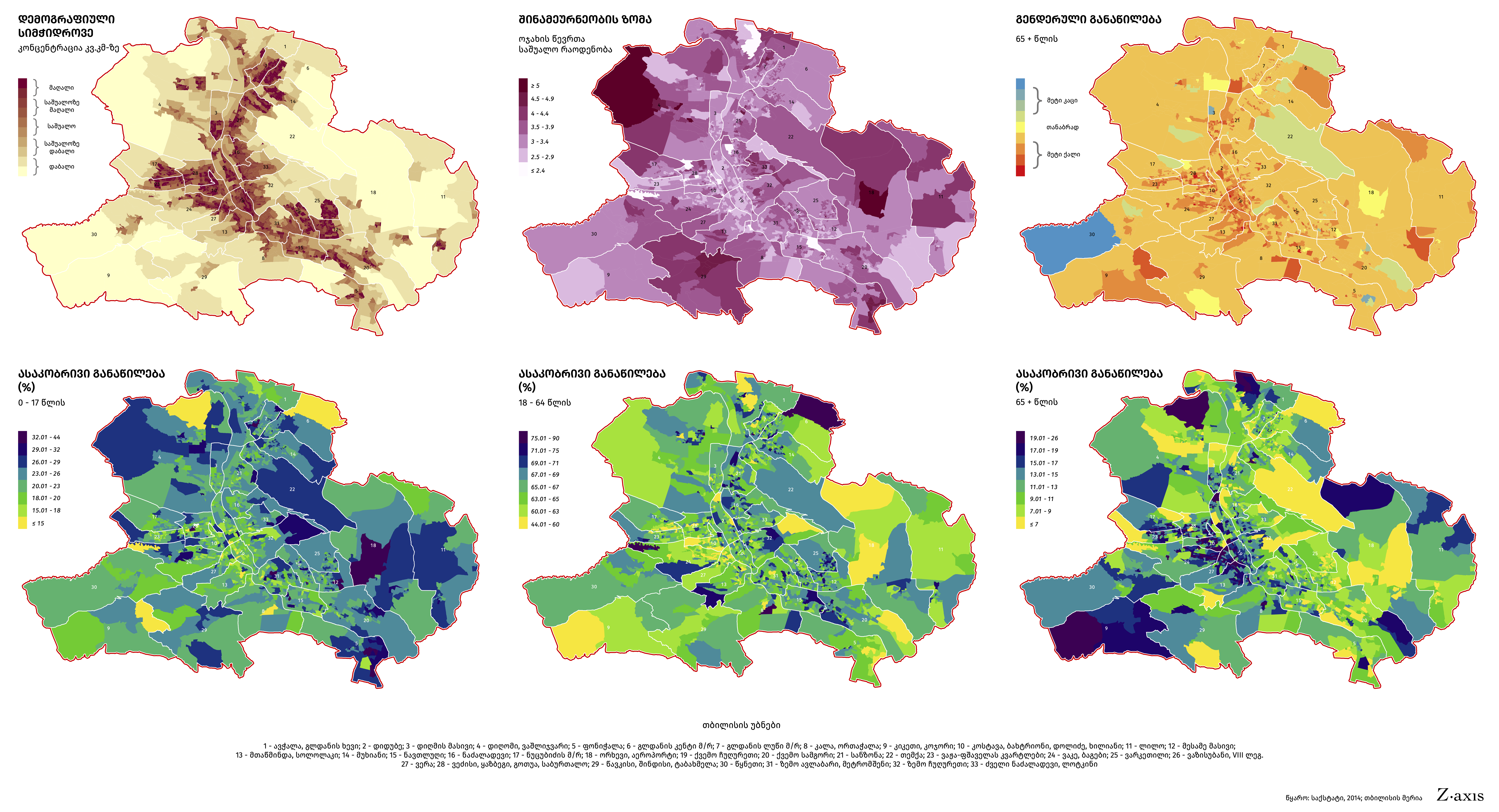
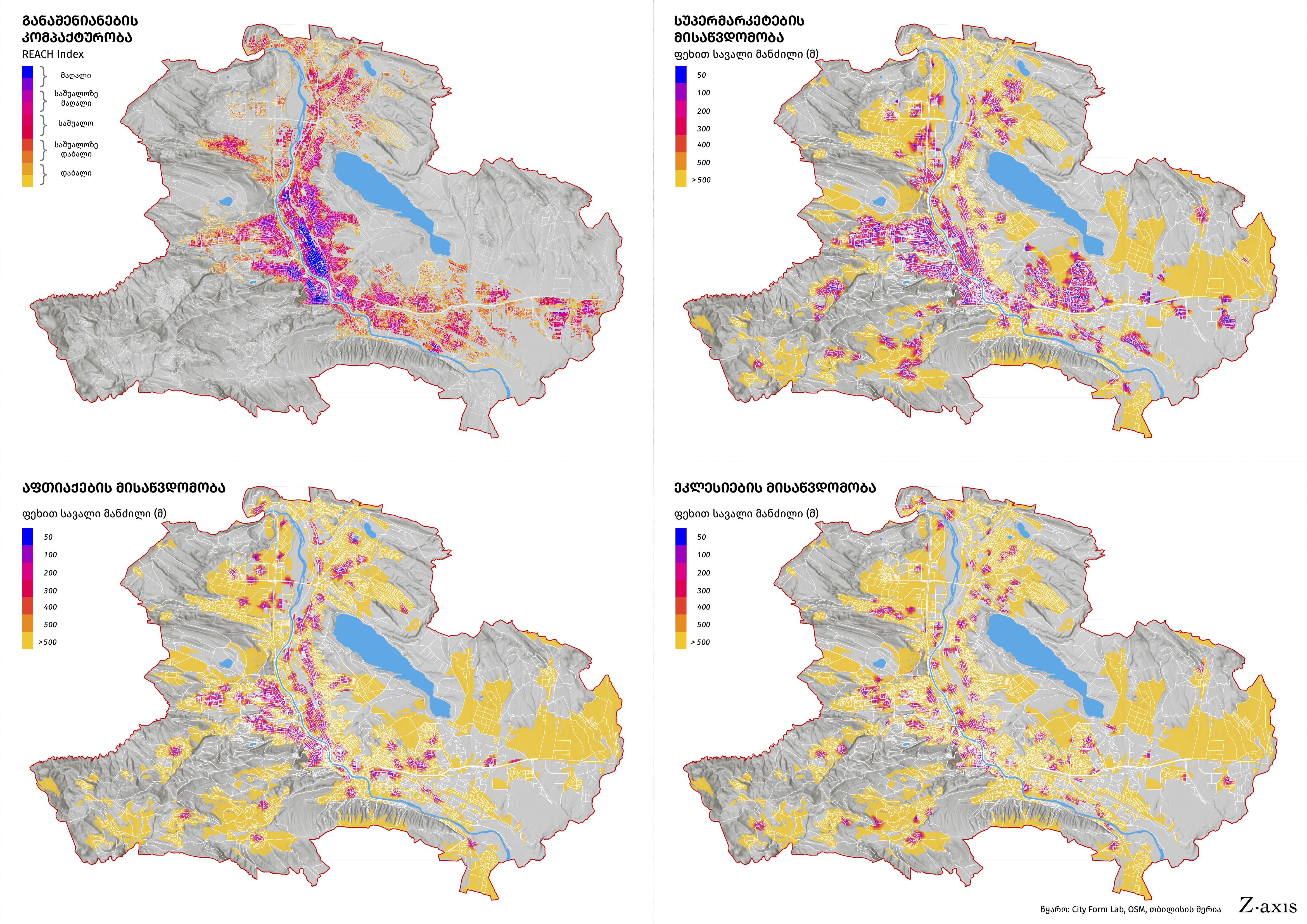
This set of visual materials (in Georgian) intends to explain some of the spatial aspects of the Covid-19 pandemic and its consequences in the context of Tbilisi, Georgia's capital and largest city, as a result of government-approved plans of complete lockdown during Orthodox Easter celebrations. Demography, density, compact urban built-environment, mobility and access to essential services and churches, sites of large religious gatherings throughout the Holy Week.
Tools Used: ArcMap; Python & Adobe Illustrator
Data: GeoSTAT, 2014; Tbilisi Household Mobility Survey, 2016; Tbilisi City Municipality; OSM


