Mukhrani
Village Center Development Plan
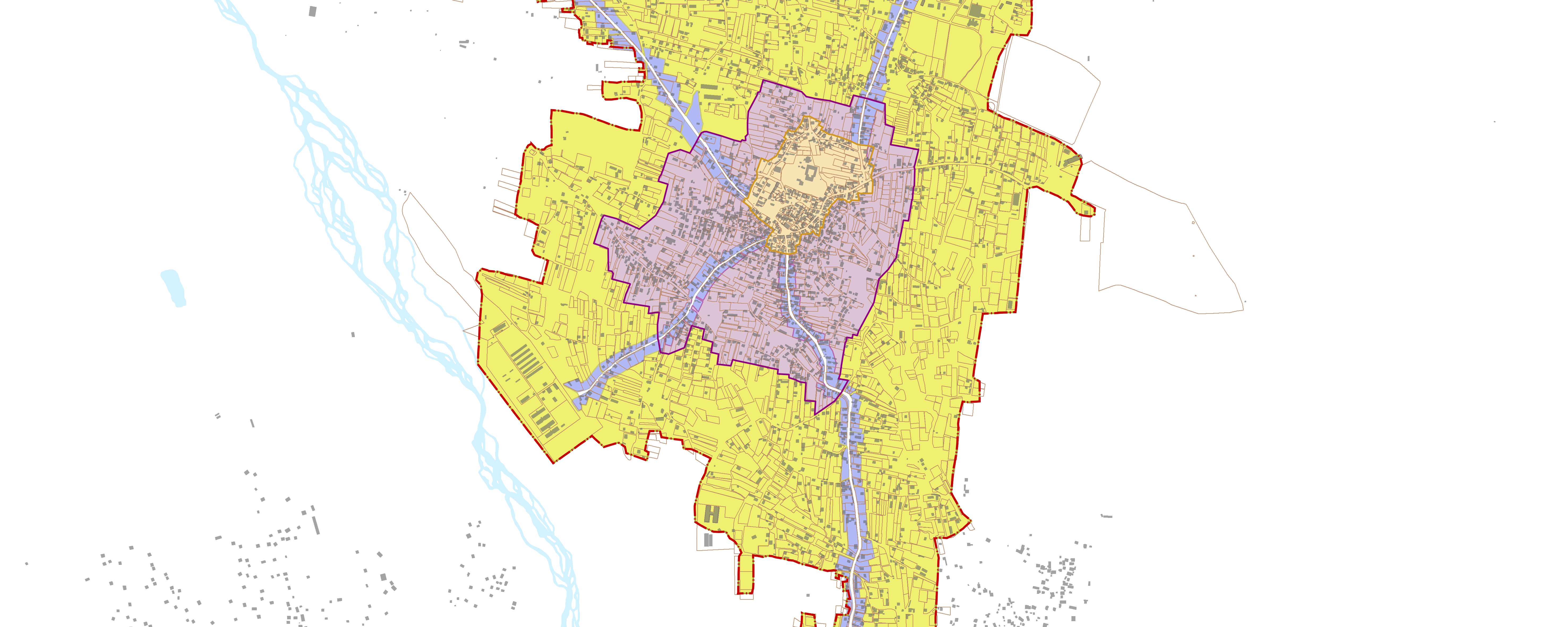
This project, which was led by Artstudio was quite extraordinary for me and distinguished itself from other projects I had implemented during my stay there. In the context of contemporary Georgian planning practice, upon my advice, the project team applied the concept of space syntax to a specific project site. This model is essential in identifying the spatial pattern of the built environment. To that end, the methodology uses street network density and building volume and closeness indices. Our model was built using the Urban Network Analysis toolbox developed at the MIT. Since we were dealing with an historic settlement, it was crucial for use to create an adequate boundary for the historic core of the village. As it is shown in the map below, the boundary area that we ended up with aligns with the spatial pattern of the existing and identified historic buildings and possible sites of cultural heritage.
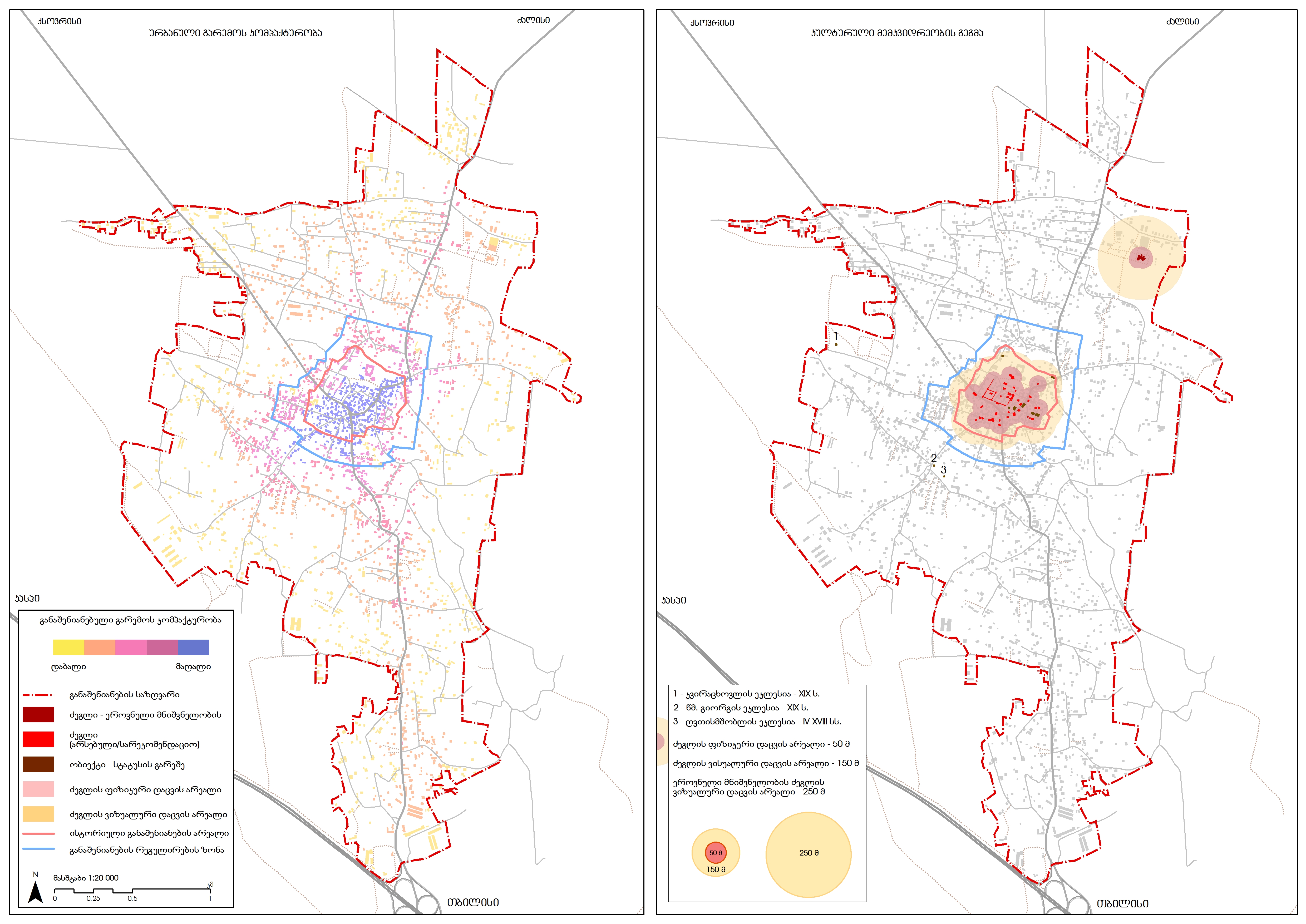
and the Concentration of the Monuments of Cultural Heritage (right)
Data: Project Team; OSM